Geolocate

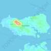
Bukit Belah topographic map

Click on the map to display elevation.

About this map

Name: Bukit Belah topographic map, elevation, terrain.

Location: Bukit Belah, Lingga, Riau Islands, Sumatra, Indonesia (-0.44158 104.41851 -0.40158 104.45851)

Average elevation: 16 m

Minimum elevation: -3 m

Maximum elevation: 66 m

Other topographic maps

Click on a map to view its topography, its elevation and its terrain.
Pulau Duyung

Indonesia > Riau Islands > Lingga

Average elevation: 2 m

Pulau Selayar

Indonesia > Riau Islands > Lingga > Penuba

Average elevation: 10 m

Gear up for your next adventure:

💡Compact LED Flashlight - Powerful and portable flashlight for outdoor use
🧢Hiking Hat - Sun-protective and breathable hats for long treks
🧥Softshell Jacket - Windproof and breathable jacket for hiking
🧥Packable Rain Jacket - Breathable waterproof layer for unpredictable weather
🚲Handlebar Phone Mount - View topographic-map.com live while cycling

As an Amazon Associate, this site earns from qualifying purchases at no extra cost to you.