
Thank you for supporting this site ❤️
Make a donation
Make a donation
Gear up for your next adventure:
As an Amazon Associate, this site earns from qualifying purchases at no extra cost to you.
Content topographic map
Click on the map to display elevation.
Thank you for supporting this site ❤️
Make a donation
Make a donation
Gear up for your next adventure:
As an Amazon Associate, this site earns from qualifying purchases at no extra cost to you.
About this map
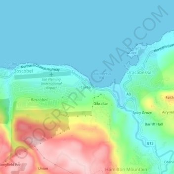
Name: Content topographic map, elevation, terrain.
Location: Content, Oracabessa, Saint Mary, Middlesex County, Jamaica (18.38144 -76.97919 18.42144 -76.93919)
Average elevation: 66 m
Minimum elevation: 0 m
Maximum elevation: 247 m
Thank you for supporting this site ❤️
Make a donation
Make a donation
Gear up for your next adventure:
As an Amazon Associate, this site earns from qualifying purchases at no extra cost to you.