Geolocate

Castello topographic map

Click on the map to display elevation.

About this map

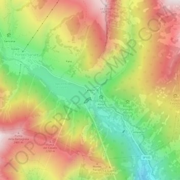
Name: Castello topographic map, elevation, terrain.

Location: Castello, Pontechianale, Cuneo, Piemonte, Italia (44.59476 7.02976 44.63476 7.06976)

Average elevation: 1,901 m

Minimum elevation: 1,341 m

Maximum elevation: 2,463 m

Other topographic maps

Click on a map to view its topography, its elevation and its terrain.

Varaita di Chianale

Italia > Piemonte > Cuneo > Pontechianale > Castello

Average elevation: 1,793 m

Gear up for your next adventure:

🥤Collapsible Travel Cup - Saves space and weight in your mess kit
🛶Canoe Life Vest - Safety vest for water sports
🔭Outdoor Binoculars - Lightweight binoculars for birdwatching and hiking
❄️Traction Ice Cleats - Slip-on spikes for icy trails and winter hiking
Bushcraft Tarp - Versatile emergency shelter or gear protection

As an Amazon Associate, this site earns from qualifying purchases at no extra cost to you.