
Thank you for supporting this site ❤️
Make a donation
Make a donation
Gear up for your next adventure:
As an Amazon Associate, this site earns from qualifying purchases at no extra cost to you.
Ciénega topographic map
Click on the map to display elevation.
Thank you for supporting this site ❤️
Make a donation
Make a donation
Gear up for your next adventure:
As an Amazon Associate, this site earns from qualifying purchases at no extra cost to you.
About this map
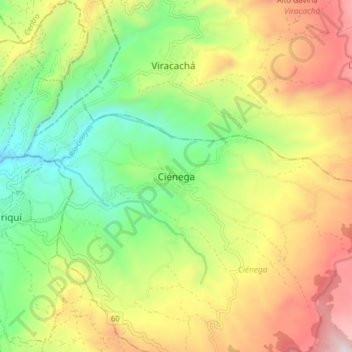
Name: Ciénega topographic map, elevation, terrain.
Location: Ciénega, Márquez, Boyacá, RAP (Especial) Central, Colombia (5.36975 -73.33548 5.44975 -73.25548)
Average elevation: 2,596 m
Minimum elevation: 2,132 m
Maximum elevation: 3,218 m
Thank you for supporting this site ❤️
Make a donation
Make a donation
Gear up for your next adventure:
As an Amazon Associate, this site earns from qualifying purchases at no extra cost to you.