Geolocate

Torre topographic map

Click on the map to display elevation.

About this map
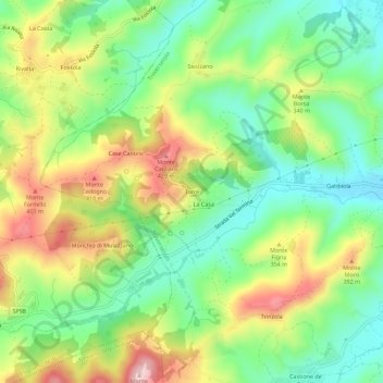
Name: Torre topographic map, elevation, terrain.

Location: Torre, Traversetolo, Parma, Emilia-Romagna, 43029, Italy (44.59949 10.32621 44.63949 10.36621)

Average elevation: 292 m

Minimum elevation: 182 m

Maximum elevation: 453 m

Gear up for your next adventure:

🧢Outdoor Visor - Breathable visor for sunny hikes
🛁Quick-Dry Microfiber Towel - Space-saving towel that dries rapidly on the move
🕶️Polarized Sunglasses - Protect your eyes with durable polarized lenses
🧦Hiking Socks - Moisture-wicking and comfortable socks for long hikes
❄️Traction Ice Cleats - Slip-on spikes for icy trails and winter hiking

As an Amazon Associate, this site earns from qualifying purchases at no extra cost to you.