Geolocate

Winslow topographic map

Click on the map to display elevation.

About this map

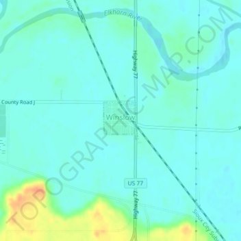
Name: Winslow topographic map, elevation, terrain.

Location: Winslow, Dodge County, Nebraska, 68072, United States (41.60670 -96.50702 41.61085 -96.50180)

Average elevation: 374 m

Minimum elevation: 365 m

Maximum elevation: 405 m

Gear up for your next adventure:

🔥Camping Stove - Portable stoves to cook outdoors with ease
🥾Trekking Boots - Durable boots for long-distance trekking
💧Hydration Bladder - Hands-free hydration solution for long treks
🛌Insulated Sleeping Pad - Critical thermal barrier between you and the cold ground
🔦LED Headlamp - Hands-free lighting for early morning starts or late finishes

As an Amazon Associate, this site earns from qualifying purchases at no extra cost to you.