Geolocate

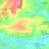
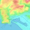
Carolles topographic map

Click on the map to display elevation.

About this map

Name: Carolles topographic map, elevation, terrain.

Location: Carolles, Avranches, Manche, Normandy, Metropolitan France, 50740, France (48.73426 -1.57437 48.76603 -1.53939)

Average elevation: 44 m

Minimum elevation: 0 m

Maximum elevation: 87 m

Other topographic maps

Click on a map to view its topography, its elevation and its terrain.
Le Petit Hameau

France > Normandy > Manche > Barneville-Carteret

Average elevation: 21 m

Le Clos Versailles

France > Normandy > Manche > La Haye-du-Puits

Average elevation: 51 m

Le Valnotte

France > Normandy > Manche > Carteret

Average elevation: 35 m

Gear up for your next adventure:

🧦Merino Wool Socks - Moisture-wicking comfort for long-distance hiking
🧼Travel Hand Sanitizer - Keep hands clean when water is scarce
🍽️Titanium Camping Spork - Ultralight and indestructible eating utensil
⛺Tent Footprint - Protect tent floor and increase durability
🧴Sunscreen SPF - Broad-spectrum sunscreen for outdoor activities

As an Amazon Associate, this site earns from qualifying purchases at no extra cost to you.