Geolocate

St. Olaf topographic map

Click on the map to display elevation.

About this map

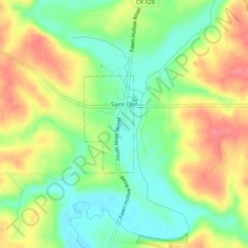
Name: St. Olaf topographic map, elevation, terrain.

Location: St. Olaf, Clayton County, Iowa, United States (42.92113 -91.39208 42.93173 -91.38466)

Average elevation: 282 m

Minimum elevation: 248 m

Maximum elevation: 322 m

Gear up for your next adventure:

🪜Heavy Duty Carabiners - Multi-use clips for securing gear to your backpack
🧥Thermal Layer - Insulating layer for cold outdoor conditions
🧦Outdoor Socks - Durable socks designed for hiking and outdoor sports
🧴Bear Spray Holster - Quick-access carry for essential Canadian wilderness safety
🎒Backpack Rain Cover - External shield to keep your entire pack dry

As an Amazon Associate, this site earns from qualifying purchases at no extra cost to you.