
Thank you for supporting this site ❤️
Make a donation
Make a donation
Gear up for your next adventure:
As an Amazon Associate, this site earns from qualifying purchases at no extra cost to you.
Malasila topographic map
Click on the map to display elevation.
Thank you for supporting this site ❤️
Make a donation
Make a donation
Gear up for your next adventure:
As an Amazon Associate, this site earns from qualifying purchases at no extra cost to you.
About this map
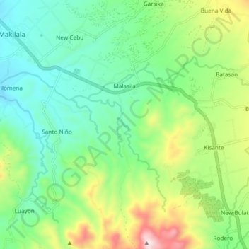
Name: Malasila topographic map, elevation, terrain.
Location: Malasila, Makilala, Cotabato, Soccsksargen, 9401, Philippines (6.88983 125.09536 6.97015 125.14742)
Average elevation: 451 m
Minimum elevation: 219 m
Maximum elevation: 967 m
Thank you for supporting this site ❤️
Make a donation
Make a donation
Gear up for your next adventure:
As an Amazon Associate, this site earns from qualifying purchases at no extra cost to you.