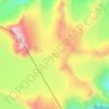
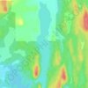
White Pass topographic map
Click on the map to display elevation.
White Pass
White Pass, also known as the Dead Horse Trail (elevation 873 m or 2,864 ft), is a mountain pass through the Boundary Ranges of the Coast Mountains on the border of the U.S. state of Alaska and the province of British Columbia, Canada. It leads from Skagway, Alaska, to the chain of lakes at the headwaters of the Yukon River (Crater Lake, Lake Lindeman, and Bennett Lake).
About this map

Name: White Pass topographic map, elevation, terrain.
Location: White Pass, Stikine Region, British Columbia, Canada (59.62545 -135.13727 59.62555 -135.13717)
Average elevation: 968 m
Minimum elevation: 853 m
Maximum elevation: 1,122 m
Other topographic maps
Click on a map to view its topography, its elevation and its terrain.