Geolocate

Koira topographic map

Click on the map to display elevation.

Koira

It is located at 21°55′0″N 85°14′0″E / 21.91667°N 85.23333°E / 21.91667; 85.23333 at an elevation of 590 m (1,940 ft) above mean sea level.

Wikipedia (CC-BY-SA 3.0)

About this map

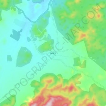
Name: Koira topographic map, elevation, terrain.

Location: Koira, Koida, Sundargarh District, Odisha, 770048, India (21.86687 85.21051 21.94687 85.29051)

Average elevation: 628 m

Minimum elevation: 544 m

Maximum elevation: 882 m

Gear up for your next adventure:

👟Sport Hiking Sandals - Breathable footwear for water crossings and camp rest
🥾Hiking Gaiters - Protect legs and shoes from mud, snow, and debris
🪜Heavy Duty Carabiners - Multi-use clips for securing gear to your backpack
💧Hydration Bladder - Hands-free hydration solution for long treks
👖Convertible Hiking Pants - Zip-off legs to adapt to changing weather conditions

As an Amazon Associate, this site earns from qualifying purchases at no extra cost to you.