Geolocate

Sentfores topographic map

Click on the map to display elevation.

About this map

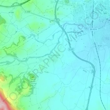
Name: Sentfores topographic map, elevation, terrain.

Location: Sentfores, Vic, Osona, Barcelona, Cataluña, 08500, España (41.89494 2.21005 41.93494 2.25005)

Average elevation: 525 m

Minimum elevation: 481 m

Maximum elevation: 779 m

Gear up for your next adventure:

🛌Down Sleeping Bag - Superior warmth-to-weight ratio for cold nights
🧢Sun Hat - Wide-brim hat for sun protection
🧦Crew Hiking Socks - Comfortable socks for long-distance hikes
🧤Thermal Hiking Gloves - Grip-enhanced gloves for cold-weather altitude trekking
Camping Groundsheet - Protect your tent from moisture and dirt

As an Amazon Associate, this site earns from qualifying purchases at no extra cost to you.