Geolocate

Tambak Sumur topographic map

Click on the map to display elevation.

About this map

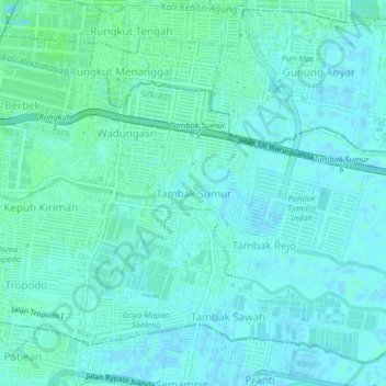
Name: Tambak Sumur topographic map, elevation, terrain.

Location: Tambak Sumur, Waru, Sidoarjo, East Java, 60293, Indonesia (-7.37076 112.75568 -7.33076 112.79568)

Average elevation: 3 m

Minimum elevation: -3 m

Maximum elevation: 6 m

Other topographic maps

Click on a map to view its topography, its elevation and its terrain.

Sedati

Indonesia > East Java > Sidoarjo

Average elevation: 1 m

Candi

Indonesia > East Java > Sidoarjo

Average elevation: 3 m

Tarik

Indonesia > East Java > Sidoarjo

Average elevation: 18 m

Balongbendo

Indonesia > East Java > Sidoarjo

Average elevation: 21 m

Wonoayu

Indonesia > East Java > Sidoarjo

Average elevation: 10 m

Porong

Indonesia > East Java > Sidoarjo

Average elevation: 22 m

Sukodono

Indonesia > East Java > Sidoarjo

Average elevation: 8 m

Jabon

Indonesia > East Java > Sidoarjo

Average elevation: 4 m

Gear up for your next adventure:

Backpacking Tent - Lightweight tent for long-distance hiking trips
🥾Light Hiking Boots - Lightweight and comfortable boots for day hikes
🧥Softshell Hiking Jacket - The perfect balance of wind protection and breathability
🥾Hiking Shorts - Breathable shorts suitable for summer hikes
💧Hydration Pack - Hands-free hydration system for long hikes

As an Amazon Associate, this site earns from qualifying purchases at no extra cost to you.