Geolocate

San Roque topographic map

Click on the map to display elevation.

About this map

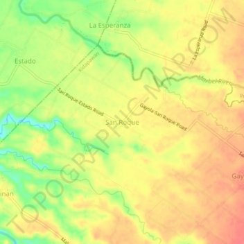
Name: San Roque topographic map, elevation, terrain.

Location: San Roque, Kidapawan, Cotabato, Soccsksargen, Philippines (7.07902 124.96908 7.11902 125.00908)

Average elevation: 87 m

Minimum elevation: 51 m

Maximum elevation: 108 m

Other topographic maps

Click on a map to view its topography, its elevation and its terrain.

Pulangi River

Philippines > Cotabato > Kidapawan

Average elevation: 440 m

Gear up for your next adventure:

🚲MTB Frame Bag - Carry tools and maps directly on your bicycle frame
🥾Hiking Gaiters - Protect legs and shoes from mud, snow, and debris
🥾Trail Hiking Shoes - Durable shoes designed for rugged trails
🛌Down Sleeping Bag - Superior warmth-to-weight ratio for cold nights
🛰️Satellite Messenger - Emergency communication for areas with no cell service

As an Amazon Associate, this site earns from qualifying purchases at no extra cost to you.