
McHenry topographic map
Click on the map to display elevation.
McHenry
It rests at an elevation of 797 feet and the Fox River flows through the eastern portion of the city. It is surrounded by natural lakes and streams, grassy moraine hills, gravel banks and shallow nutrient-rich peat bogs, remnants of receding glaciers from the last ice age. Moraine Hills State Park and Volo Bog State Natural Area preserve some of these natural features.
About this map
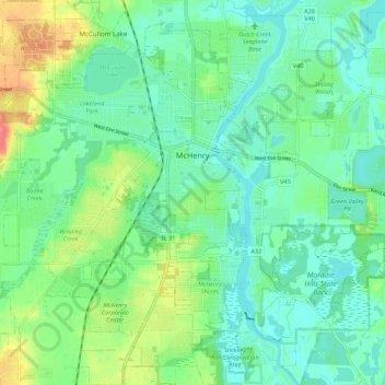
Name: McHenry topographic map, elevation, terrain.
Location: McHenry, McHenry County, Illinois, United States (42.29938 -88.34578 42.37125 -88.23793)
Average elevation: 237 m
Minimum elevation: 218 m
Maximum elevation: 282 m
Other topographic maps
Click on a map to view its topography, its elevation and its terrain.
Silver Creek Conservation Area
United States > Illinois > McHenry County > Prairie Grove
Average elevation: 232 m