Geolocate

Snyderville topographic map

Click on the map to display elevation.

About this map

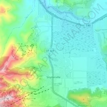
Name: Snyderville topographic map, elevation, terrain.

Location: Snyderville, Summit County, Utah, United States (40.67924 -111.54670 40.73436 -111.47254)

Average elevation: 2,013 m

Minimum elevation: 1,928 m

Maximum elevation: 2,258 m

Gear up for your next adventure:

🥾Mountain Trail Shoes - High-traction shoes for mountain trails
🥾Mountain Hiking Shoes - Shoes with superior grip for mountainous terrain
💡Compact LED Flashlight - Powerful and portable flashlight for outdoor use
🧥Insulated Jacket - Keep warm in cold outdoor conditions
🧣Merino Neck Gaiter - Protects against wind, sun, and cold at high altitudes

As an Amazon Associate, this site earns from qualifying purchases at no extra cost to you.