
Make a donation
Gear up for your next adventure:
As an Amazon Associate, this site earns from qualifying purchases at no extra cost to you.
The Sugar Loaf topographic map
Click on the map to display elevation.
Make a donation
Gear up for your next adventure:
As an Amazon Associate, this site earns from qualifying purchases at no extra cost to you.
About this map
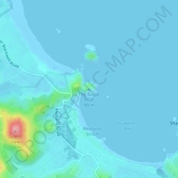
Name: The Sugar Loaf topographic map, elevation, terrain.
Average elevation: 9 m
Minimum elevation: -3 m
Maximum elevation: 129 m
Make a donation
Gear up for your next adventure:
As an Amazon Associate, this site earns from qualifying purchases at no extra cost to you.
Other topographic maps
Click on a map to view its topography, its elevation and its terrain.
Little Barrier Island
New Zealand > Auckland > Aotea Great Barrier
The island is steeply sloping, and deeply dissected by ravines radiating from a central range that peaks at Mount Hauturu whose altitude is 722 m (2,369 ft). Te Titoki Point is the only area of flat land on the island.
Average elevation: 145 m