Geolocate

Shagar topographic map

Click on the map to display elevation.

About this map

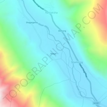
Name: Shagar topographic map, elevation, terrain.

Location: Shagar, Shamiling, Zanskar, Ladakh, India (33.52788 76.74241 33.56788 76.78241)

Average elevation: 3,845 m

Minimum elevation: 3,561 m

Maximum elevation: 4,743 m

Gear up for your next adventure:

Camping Coffee Maker - Brew fresh coffee anywhere on the topographic map
🧥Thermal Layer - Insulating layer for cold outdoor conditions
🛰️Satellite Messenger - Emergency communication for areas with no cell service
🧼Biodegradable Camp Soap - Environmentally friendly cleaning for gear and body
🧢Outdoor Visor - Breathable visor for sunny hikes

As an Amazon Associate, this site earns from qualifying purchases at no extra cost to you.