
Thank you for supporting this site ❤️
Make a donation
Make a donation
Gear up for your next adventure:
As an Amazon Associate, this site earns from qualifying purchases at no extra cost to you.
Montarecos topographic map
Click on the map to display elevation.
Thank you for supporting this site ❤️
Make a donation
Make a donation
Gear up for your next adventure:
As an Amazon Associate, this site earns from qualifying purchases at no extra cost to you.
About this map
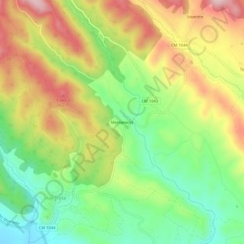
Name: Montarecos topographic map, elevation, terrain.
Location: Montarecos, Alegrete, Portalegre, 7300-328, Portugal (39.23242 -7.32839 39.27242 -7.28839)
Average elevation: 529 m
Minimum elevation: 392 m
Maximum elevation: 693 m
Thank you for supporting this site ❤️
Make a donation
Make a donation
Gear up for your next adventure:
As an Amazon Associate, this site earns from qualifying purchases at no extra cost to you.