Geolocate

Guayabitos topographic map

Click on the map to display elevation.

About this map

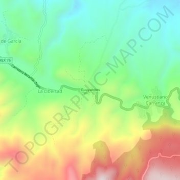
Name: Guayabitos topographic map, elevation, terrain.

Location: Guayabitos, La Libertad, Tepic, Nayarit, 63711, Mexico (21.50086 -105.02128 21.54086 -104.98128)

Average elevation: 1,126 m

Minimum elevation: 834 m

Maximum elevation: 1,583 m

Gear up for your next adventure:

🥾All-Terrain Hiking Boots - Versatile boots for varied hiking conditions
🏃Hydration Running Vest - Carry water and maps close to your body for speed
🥾Hiking Gaiters - Protect legs and shoes from mud, snow, and debris
🦶Anti-Blister Balm - Prevents friction and hotspots during long ascents
🎒Backpack Rain Cover - External shield to keep your entire pack dry

As an Amazon Associate, this site earns from qualifying purchases at no extra cost to you.