Geolocate

Calabasa topographic map

Click on the map to display elevation.

About this map

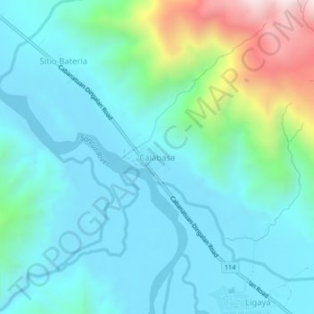
Name: Calabasa topographic map, elevation, terrain.

Location: Calabasa, Gabaldon, Nueva Ecija, Central Luzon, Philippines (15.50882 121.25690 15.54882 121.29690)

Average elevation: 273 m

Minimum elevation: 89 m

Maximum elevation: 1,022 m

Other topographic maps

Click on a map to view its topography, its elevation and its terrain.

Dupinga River

Philippines > Nueva Ecija > Gabaldon

Average elevation: 650 m

Gear up for your next adventure:

🐕Hiking Dog Pack - Let your canine companion carry their own water and food
🥾Waterproof Hiking Boots - Boots keeping your feet dry in wet conditions
🔭Compact Binoculars - Lightweight optics for scouting trails and wildlife
🚲Handlebar Phone Mount - View topographic-map.com live while cycling
Bushcraft Tarp - Versatile emergency shelter or gear protection

As an Amazon Associate, this site earns from qualifying purchases at no extra cost to you.