Geolocate

Almeria topographic map

Click on the map to display elevation.

About this map
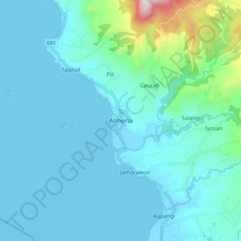
Name: Almeria topographic map, elevation, terrain.

Location: Almeria, Biliran, Eastern Visayas, 0000, Philippines (11.58028 124.34167 11.66028 124.42167)

Average elevation: 100 m

Minimum elevation: -1 m

Maximum elevation: 817 m

Other topographic maps

Click on a map to view its topography, its elevation and its terrain.

Biliran

Philippines > Biliran

Average elevation: 170 m

Maripipi

Philippines > Biliran

Average elevation: 52 m

Sambawan Islands

Philippines > Biliran > Maripipi

Average elevation: 0 m

Anas River

Philippines > Biliran > Larrazabal

Average elevation: 200 m

Biliran

Philippines > Biliran

Average elevation: 170 m

Gear up for your next adventure:

🦶Anti-Blister Balm - Prevents friction and hotspots during long ascents
🔦LED Headtorch - Bright and durable light for night activities
🧥Softshell Hiking Jacket - The perfect balance of wind protection and breathability
🧴Sunscreen SPF - Broad-spectrum sunscreen for outdoor activities
🧢Beanie Hat - Keep your head warm in cold weather

As an Amazon Associate, this site earns from qualifying purchases at no extra cost to you.