Geolocate

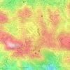
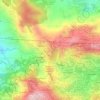
Sunshine Park topographic map

Click on the map to display elevation.

About this map

Name: Sunshine Park topographic map, elevation, terrain.

Location: Sunshine Park, Military Cut-Off, District 13, Central Business District, Baguio, Cordillera Administrative Region, 2600, Philippines (16.40581 120.59843 16.40704 120.59962)

Average elevation: 1,444 m

Minimum elevation: 1,266 m

Maximum elevation: 1,550 m

Other topographic maps

Click on a map to view its topography, its elevation and its terrain.
Ferdinand

Philippines > Baguio

Average elevation: 1,416 m

Burnham Park

Philippines > Baguio

Average elevation: 1,445 m

Upper Magsaysay

Philippines > Baguio > Upper Magsaysay

Average elevation: 1,456 m

Palma - Urbano

Philippines > Baguio

Average elevation: 1,432 m

Salud Mitra

Philippines > Baguio

Average elevation: 1,444 m

Harrison-Claudio-Carantes

Philippines > Baguio

Average elevation: 1,446 m

Panagbenga Park

Philippines > Baguio

Average elevation: 1,442 m

Dominican Hill

Philippines > Baguio

Average elevation: 1,434 m

Poblacion

Philippines > Baguio

Average elevation: 1,292 m

Bayan Park

Philippines > Baguio

Average elevation: 1,470 m

Pine Trees of the World Park

Philippines > Baguio

Average elevation: 1,436 m

Pacdal Circle Park

Philippines > Baguio

Average elevation: 1,482 m

Lagoon Tunnel

Philippines > Baguio

Average elevation: 1,421 m

Mines View Park

Philippines > Baguio

Average elevation: 1,439 m

Tam-Awan Village

Philippines > Baguio

Average elevation: 1,430 m

Gear up for your next adventure:

🚲Bike Repair Kit - Essential tools for on-trail mechanical issues
🧴Waterproofing Spray - Restore the DWR coating on jackets and tents
🚲Heavy Duty Bike Lock - Secure your bike at the trailhead or during stops
🧢Sun Hat - Wide-brim hat for sun protection
🧰Emergency Multi-Tool - Compact multi-tool for outdoor survival

As an Amazon Associate, this site earns from qualifying purchases at no extra cost to you.