Geolocate

Pungarehu topographic map

Click on the map to display elevation.

About this map

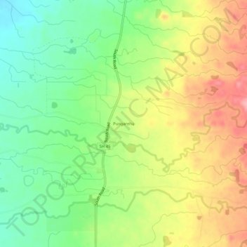
Name: Pungarehu topographic map, elevation, terrain.

Location: Pungarehu, South Taranaki District, Taranaki, New Zealand (-39.29728 173.79073 -39.25728 173.83073)

Average elevation: 78 m

Minimum elevation: 24 m

Maximum elevation: 143 m

Other topographic maps

Click on a map to view its topography, its elevation and its terrain.

Pātea

New Zealand > Taranaki > South Taranaki District

Average elevation: 29 m

Gear up for your next adventure:

🧰Emergency Multi-Tool - Compact multi-tool for outdoor survival
🎒Hiking Backpack - Lightweight and ergonomic backpacks for day hikes or multi-day treks
🎒Fully Waterproof Backpack - Total protection for photography gear and electronics
🧰Multitool Knife - Compact and versatile tool for outdoor use
🧦Thermal Socks - Warm socks for winter hiking or camping

As an Amazon Associate, this site earns from qualifying purchases at no extra cost to you.