Geolocate

Coatzacoalcos topographic map

Click on the map to display elevation.

About this map

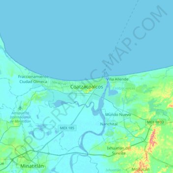
Name: Coatzacoalcos topographic map, elevation, terrain.

Location: Coatzacoalcos, Veracruz, 96576, Mexico (17.98050 -94.59440 18.30050 -94.27440)

Average elevation: 11 m

Minimum elevation: -3 m

Maximum elevation: 139 m

Other topographic maps

Click on a map to view its topography, its elevation and its terrain.

Playa Sol

Mexico > Veracruz > Coatzacoalcos

Average elevation: 10 m

Gear up for your next adventure:

🔪Outdoor Multitool - Versatile tool for repairs and food prep in the wild
🧥Ultralight Puffy Jacket - Maximum warmth that packs down to the size of an orange
🧴Sunscreen SPF - Broad-spectrum sunscreen for outdoor activities
🥾Mountain Trail Shoes - High-traction shoes for mountain trails
🥾Mountain Hiking Boots - High-traction boots for rocky terrain

As an Amazon Associate, this site earns from qualifying purchases at no extra cost to you.