
Titi topographic map
Click on the map to display elevation.
About this map
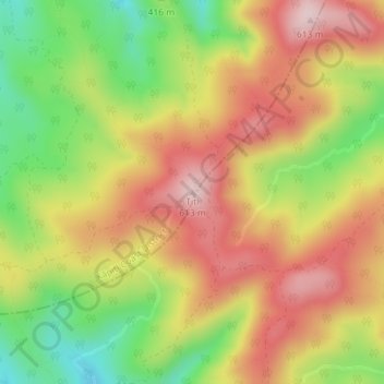
Name: Titi topographic map, elevation, terrain.
Location: Titi, Kāpiti Coast District, Wellington, New Zealand (-40.99067 175.03155 -40.99057 175.03165)
Average elevation: 455 m
Minimum elevation: 284 m
Maximum elevation: 605 m
Other topographic maps
Click on a map to view its topography, its elevation and its terrain.
Kapiti Island
New Zealand > Wellington > Kapiti Coast District
The full original name for the island is Te Waewae-Kapiti-o-Tara-rāua-ko-Rangitāne, meaning "the boundary of Tara and Rangitāne" and referring to it as a place where the rohe (territories) of Ngāi Tara (now known as Muaūpoko) and Rangitāne (descendents of Whātonga) iwi adjoined each other. The word…
Average elevation: 55 m
Kapiti Island
New Zealand > Wellington > Kapiti Coast District
The full original name for the island, Ko te Waewae-Kapiti-o-Tara-rāua-ko-Rangitāne, meaning "the boundary of Tara and Rangitāne", refers to it as a place where the rohe (territories) of Ngāi Tara (now known as Muaūpoko) and Rangitāne iwi adjoined each other. The word kapiti (to be joined) is spelt…
Average elevation: 55 m