Geolocate

Valdanta topographic map

Click on the map to display elevation.

About this map

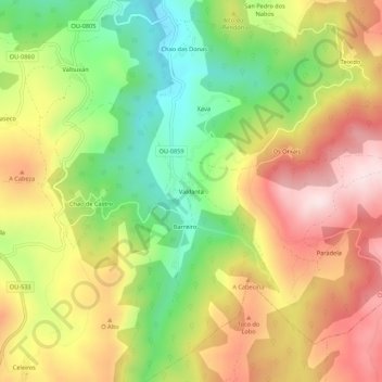
Name: Valdanta topographic map, elevation, terrain.

Location: Valdanta, O Bolo, Valdeorras, Orense, Galicia, 32373, España (42.25568 -7.11027 42.29568 -7.07027)

Average elevation: 867 m

Minimum elevation: 663 m

Maximum elevation: 1,074 m

Gear up for your next adventure:

🥾Trail Hiking Socks - Comfortable socks to prevent blisters and fatigue
🧤Insulated Winter Gloves - Heavy-duty protection for sub-zero Canadian adventures
🥾Trail Running Shoes - Lightweight and durable shoes for trail running
🧰Multitool Knife - Compact and versatile tool for outdoor use
Camping Coffee Maker - Brew fresh coffee anywhere on the topographic map

As an Amazon Associate, this site earns from qualifying purchases at no extra cost to you.