
Thank you for supporting this site ❤️
Make a donation
Make a donation
Gear up for your next adventure:
As an Amazon Associate, this site earns from qualifying purchases at no extra cost to you.
Naidupeta topographic map
Click on the map to display elevation.
Thank you for supporting this site ❤️
Make a donation
Make a donation
Gear up for your next adventure:
As an Amazon Associate, this site earns from qualifying purchases at no extra cost to you.
About this map
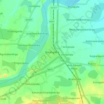
Name: Naidupeta topographic map, elevation, terrain.
Location: Naidupeta, Naidupet, Tirupati, Andhra Pradesh, 524126, India (13.86909 79.85653 13.94909 79.93653)
Average elevation: 30 m
Minimum elevation: 20 m
Maximum elevation: 48 m
Thank you for supporting this site ❤️
Make a donation
Make a donation
Gear up for your next adventure:
As an Amazon Associate, this site earns from qualifying purchases at no extra cost to you.