
Le Belley topographic map
Interactive map
Click on the map to display elevation.
About this map
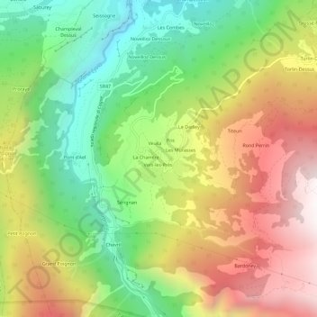
Name: Le Belley topographic map, elevation, terrain.
Location: Le Belley, Aymavilles, Vallée d'Aoste, 11010, Italie (45.65697 7.21817 45.69697 7.25817)
Average elevation: 1,395 m
Minimum elevation: 672 m
Maximum elevation: 2,266 m
Other topographic maps
Click on a map to view its topography, its elevation and its terrain.
Le Bettex
Italie > Vallée d'Aoste > Aymavilles
Le Bettex, Aymavilles, Vallée d'Aoste, 11018, Italie
Average elevation: 955 m