Geolocate

Pavignano topographic map

Click on the map to display elevation.

About this map

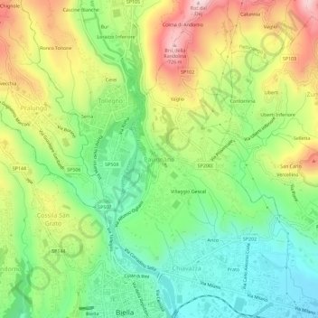
Name: Pavignano topographic map, elevation, terrain.

Location: Pavignano, Biella, Piemonte, 13818, Italia (45.56567 8.04048 45.60567 8.08048)

Average elevation: 501 m

Minimum elevation: 346 m

Maximum elevation: 730 m

Gear up for your next adventure:

🪑Insulated Seat Pad - Protect your seat from cold rocks and wet logs
🧼Travel Hand Sanitizer - Keep hands clean when water is scarce
🎒Hiking Backpack - Lightweight and ergonomic backpacks for day hikes or multi-day treks
🥾Waterproof Hiking Shoes - Durable shoes for wet and rugged trails
🕯️Camping Lantern - Illuminates your entire campsite with high-efficiency LEDs

As an Amazon Associate, this site earns from qualifying purchases at no extra cost to you.