Geolocate

Sindri topographic map

Click on the map to display elevation.

About this map

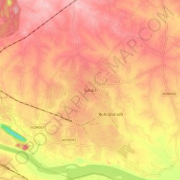
Name: Sindri topographic map, elevation, terrain.

Location: Sindri, Baliapur, Dhanbad, Jharkhand, 828122, India (23.63515 86.44963 23.71515 86.52963)

Average elevation: 160 m

Minimum elevation: 60 m

Maximum elevation: 205 m

Gear up for your next adventure:

🧢Hiking Hat - Sun-protective and breathable hats for long treks
🥾Mountain Hiking Shoes - Shoes with superior grip for mountainous terrain
🛏️Camping Sleeping Mat - Comfortable mats for sleeping outdoors
Camping Coffee Maker - Brew fresh coffee anywhere on the topographic map
💡Solar Camping Lamp - Eco-friendly lighting for campsites

As an Amazon Associate, this site earns from qualifying purchases at no extra cost to you.