Geolocate

Collet des Clots topographic map

Click on the map to display elevation.

About this map

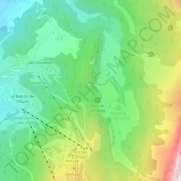
Name: Collet des Clots topographic map, elevation, terrain.

Location: Collet des Clots, Villard-de-Lans, Grenoble, Isère, Auvergne-Rhône-Alpes, France métropolitaine, 38250, France (45.04758 5.57390 45.04768 5.57400)

Average elevation: 1,361 m

Minimum elevation: 1,046 m

Maximum elevation: 1,960 m

Other topographic maps

Click on a map to view its topography, its elevation and its terrain.

Gear up for your next adventure:

🏕️Camping Hammock - Integrated protection for sleeping between trees
💡Compact LED Flashlight - Powerful and portable flashlight for outdoor use
Camping Groundsheet - Protect your tent from moisture and dirt
💡LED Camping Lantern - Illuminate your campsite with long-lasting lanterns
🧰Multitool Knife - Compact and versatile tool for outdoor use

As an Amazon Associate, this site earns from qualifying purchases at no extra cost to you.