
Taman Merdeka topographic map
Click on the map to display elevation.
About this map
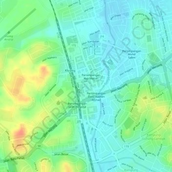
Name: Taman Merdeka topographic map, elevation, terrain.
Location: Taman Merdeka, Kluang, Johor, Malaysia (2.03176 103.31872 2.03285 103.31957)
Average elevation: 44 m
Minimum elevation: 26 m
Maximum elevation: 75 m
Other topographic maps
Click on a map to view its topography, its elevation and its terrain.