Geolocate

Clariana topographic map

Click on the map to display elevation.

About this map

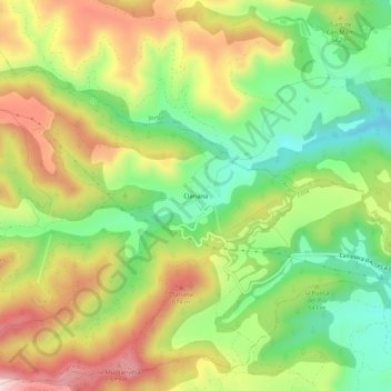
Name: Clariana topographic map, elevation, terrain.

Location: Clariana, Argençola, Anoia, Barcelona, Cataluña, 08717, España (41.57103 1.47820 41.61103 1.51820)

Average elevation: 541 m

Minimum elevation: 384 m

Maximum elevation: 731 m

Gear up for your next adventure:

🛌Insulated Sleeping Pad - Critical thermal barrier between you and the cold ground
🥾Waterproof Trail Shoes - Shoes designed to handle wet terrain
🚑Survival Whistle - Signal for help across long distances in mountains
🔦UV Flashlight - Detect minerals or specific insects in the dark
🛶Kayak Accessories - Essential gear for safe and fun kayaking adventures

As an Amazon Associate, this site earns from qualifying purchases at no extra cost to you.