Geolocate

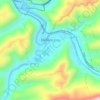
Pinsonfork topographic map

Click on the map to display elevation.

About this map

Name: Pinsonfork topographic map, elevation, terrain.

Location: Pinsonfork, Pike County, Kentucky, 41555, United States (37.53316 -82.28375 37.57316 -82.24375)

Average elevation: 396 m

Minimum elevation: 245 m

Maximum elevation: 606 m

Other topographic maps

Click on a map to view its topography, its elevation and its terrain.
Pikeville

United States > Kentucky > Pike County

Average elevation: 338 m

Elkhorn City

United States > Kentucky > Pike County

Average elevation: 364 m

Crow Hollow

United States > Kentucky > Pike County > Douglas

Average elevation: 348 m

Gear up for your next adventure:

👟Leg Gaiters - Keep debris, mud, and snow out of your boots
💧Filtered Water Bottle - Safe drinking water on the go
🧦Hiking Socks - Moisture-wicking and comfortable socks for long hikes
🔋Lithium AA Batteries - Long-lasting power that performs in extreme cold
❄️Traction Ice Cleats - Slip-on spikes for icy trails and winter hiking

As an Amazon Associate, this site earns from qualifying purchases at no extra cost to you.