Geolocate

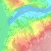
Harvey Rural Community topographic map

Click on the map to display elevation.

About this map

Name: Harvey Rural Community topographic map, elevation, terrain.

Location: Harvey Rural Community, York County, New Brunswick, Canada (45.50068 -67.23552 45.92706 -66.86367)

Average elevation: 132 m

Minimum elevation: 28 m

Maximum elevation: 310 m

York County trails, hiking, mountain biking, running and outdoor activities

Other topographic maps

Click on a map to view its topography, its elevation and its terrain.

McGivney

Canada > New Brunswick > York County > McGivney

Average elevation: 179 m

Kingsclear

Canada > New Brunswick > York County

Average elevation: 76 m

Douglas

Canada > New Brunswick > York County > Fredericton

Average elevation: 48 m

Kingsclear

Canada > New Brunswick > York County

Average elevation: 76 m

Kingsclear

Canada > New Brunswick > York County

Average elevation: 76 m

Gear up for your next adventure:

🛏️Sleeping Bag - Warm and compact sleeping bags for outdoor camping
🧦Outdoor Socks - Durable socks designed for hiking and outdoor sports
🥾Trekking Boots - Durable boots for long-distance trekking
🧢Outdoor Cap - Protective cap for sun and rain during hikes
🥾Waterproof Hiking Shoes - Durable shoes for wet and rugged trails

As an Amazon Associate, this site earns from qualifying purchases at no extra cost to you.