Geolocate

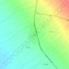
Sirjan topographic map

Click on the map to display elevation.

About this map

Name: Sirjan topographic map, elevation, terrain.

Location: Sirjan, Central District Sirjan County, Sirjan County, Kerman Province, Iran (29.38554 55.62069 29.52433 55.73582)

Average elevation: 1,742 m

Minimum elevation: 1,698 m

Maximum elevation: 1,836 m

Other topographic maps

Click on a map to view its topography, its elevation and its terrain.
Gear up for your next adventure:

🔦LED Headlamp - Hands-free lighting for early morning starts or late finishes
🥾Mountaineering Boots - Supportive boots for climbing and high-altitude hiking
🧳Compression Sacks - Maximize space in your backpack by shrinking gear
🔋Lithium AA Batteries - Long-lasting power that performs in extreme cold
📷Outdoor Action Camera - Capture high-elevation views and rugged adventures

As an Amazon Associate, this site earns from qualifying purchases at no extra cost to you.