Geolocate

Caldera topographic map

Click on the map to display elevation.

About this map

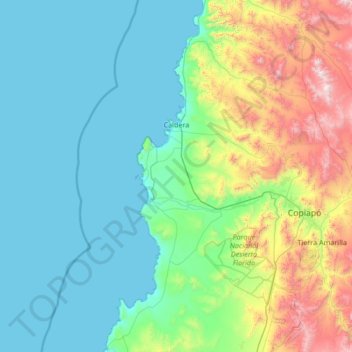
Name: Caldera topographic map, elevation, terrain.

Location: Caldera, Provincia de Copiapó, Atacama Region, Chile (-27.83756 -70.97690 -26.64312 -70.24548)

Average elevation: 374 m

Minimum elevation: 0 m

Maximum elevation: 2,041 m

Other topographic maps

Click on a map to view its topography, its elevation and its terrain.

Gear up for your next adventure:

🥾Waterproof Trail Shoes - Shoes designed to handle wet terrain
🥾All-Terrain Hiking Boots - Versatile boots for varied hiking conditions
💧Hydration Pack - Hands-free hydration system for long hikes
🧭GPS Outdoor Watch - Smart watch for navigation and fitness tracking in nature
🔋Lithium AA Batteries - Long-lasting power that performs in extreme cold

As an Amazon Associate, this site earns from qualifying purchases at no extra cost to you.