Geolocate

Wen topographic map

Click on the map to display elevation.

About this map

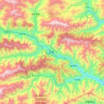
Name: Wen topographic map, elevation, terrain.

Location: Wen, Wen County, Longnan City, Gansu, China (32.78700 104.51904 33.10700 104.83904)

Average elevation: 1,823 m

Minimum elevation: 788 m

Maximum elevation: 3,190 m

Gear up for your next adventure:

🛏️Sleeping Bag - Warm and compact sleeping bags for outdoor camping
🏃Hydration Running Vest - Carry water and maps close to your body for speed
💧Filtered Water Bottle - Safe drinking water on the go
🧢Sun Hat - Wide-brim hat for sun protection
🛌Insulated Sleeping Pad - Critical thermal barrier between you and the cold ground

As an Amazon Associate, this site earns from qualifying purchases at no extra cost to you.