
Saint George Parish topographic map
Click on the map to display elevation.
About this map
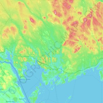
Name: Saint George Parish topographic map, elevation, terrain.
Location: Saint George Parish, Charlotte County, New Brunswick, Canada (44.94548 -66.93798 45.50313 -66.76513)
Average elevation: 78 m
Minimum elevation: -2 m
Maximum elevation: 358 m
Charlotte County trails, hiking, mountain biking, running and outdoor activities
Other topographic maps
Click on a map to view its topography, its elevation and its terrain.
Simpson Corner
Canada > New Brunswick > Charlotte County > Municipal District of St. Stephen
Average elevation: 27 m
Saint Andrews
Canada > New Brunswick > Charlotte County > Town of Saint Andrews
Average elevation: 7 m
Heathland
Canada > New Brunswick > Charlotte County > Municipal District of St. Stephen
Average elevation: 64 m