
Thank you for supporting this site ❤️
Make a donation
Make a donation
Gear up for your next adventure:
As an Amazon Associate, this site earns from qualifying purchases at no extra cost to you.
Biljurashi topographic map
Click on the map to display elevation.
Thank you for supporting this site ❤️
Make a donation
Make a donation
Gear up for your next adventure:
As an Amazon Associate, this site earns from qualifying purchases at no extra cost to you.
About this map
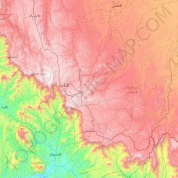
Name: Biljurashi topographic map, elevation, terrain.
Location: Biljurashi, بني كبير, Al-Bahah Province, Saudi Arabia (19.69809 41.50283 20.29958 41.97897)
Average elevation: 1,602 m
Minimum elevation: 278 m
Maximum elevation: 2,563 m
Thank you for supporting this site ❤️
Make a donation
Make a donation
Gear up for your next adventure:
As an Amazon Associate, this site earns from qualifying purchases at no extra cost to you.