Geolocate

Alderley topographic map

Click on the map to display elevation.

About this map

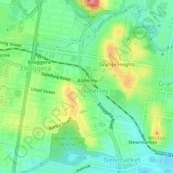
Name: Alderley topographic map, elevation, terrain.

Location: Alderley, Brisbane City, Queensland, 4051, Australia (-27.43762 152.99241 -27.41272 153.00908)

Average elevation: 36 m

Minimum elevation: 5 m

Maximum elevation: 91 m

Other topographic maps

Click on a map to view its topography, its elevation and its terrain.

Willmington Park

Australia > Queensland > Brisbane City

Average elevation: 37 m

Mount Gravatt

Australia > Queensland > Brisbane City

Average elevation: 70 m

Ithaca

Australia > Queensland > Brisbane City > Ithaca

Average elevation: 31 m

Gear up for your next adventure:

🚑Survival Whistle - Signal for help across long distances in mountains
🧦Merino Wool Socks - Moisture-wicking comfort for long-distance hiking
🧊Portable Cooler - Keep food and drinks cold during outdoor adventures
🧣Evaporative Cooling Towel - Beat the heat during intense summer climbs
🏃Hydration Running Vest - Carry water and maps close to your body for speed

As an Amazon Associate, this site earns from qualifying purchases at no extra cost to you.