
Thank you for supporting this site ❤️
Make a donation
Make a donation
Gear up for your next adventure:
As an Amazon Associate, this site earns from qualifying purchases at no extra cost to you.
Khujand topographic map
Click on the map to display elevation.
Thank you for supporting this site ❤️
Make a donation
Make a donation
Gear up for your next adventure:
As an Amazon Associate, this site earns from qualifying purchases at no extra cost to you.
About this map
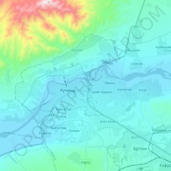
Name: Khujand topographic map, elevation, terrain.
Location: Khujand, Ghafurov District, Sughd Region, 735700, Tajikistan (40.23580 69.54105 40.34053 69.72885)
Average elevation: 510 m
Minimum elevation: 319 m
Maximum elevation: 1,613 m
Thank you for supporting this site ❤️
Make a donation
Make a donation
Gear up for your next adventure:
As an Amazon Associate, this site earns from qualifying purchases at no extra cost to you.