Geolocate

Ralli topographic map

Click on the map to display elevation.

About this map

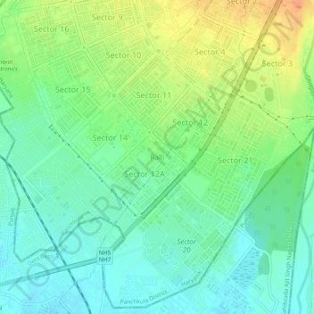
Name: Ralli topographic map, elevation, terrain.

Location: Ralli, Panchkula, Haryana, 134117, India (30.65680 76.83291 30.69680 76.87291)

Average elevation: 324 m

Minimum elevation: 308 m

Maximum elevation: 351 m

Gear up for your next adventure:

Lightweight Backpacking Tent - Compact tent for efficient hiking trips
🧴Insect Repellent - Protect yourself from bugs during outdoor adventures
🏕️Camping Hammock - Integrated protection for sleeping between trees
🧥Softshell Jacket - Windproof and breathable jacket for hiking
Lightweight Camping Tent - Portable shelter optimized for Canadian backcountry camping

As an Amazon Associate, this site earns from qualifying purchases at no extra cost to you.