Geolocate

Guamal topographic map

Click on the map to display elevation.

About this map

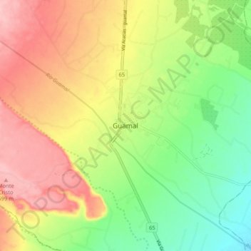
Name: Guamal topographic map, elevation, terrain.

Location: Guamal, Piedemonte, Meta, Colombia (3.83727 -73.81014 3.91727 -73.73014)

Average elevation: 526 m

Minimum elevation: 453 m

Maximum elevation: 605 m

Gear up for your next adventure:

🧳Compression Sacks - Maximize space in your backpack by shrinking gear
🪑Ultralight Camping Stool - Compact seating for rest stops during long hikes
🥾Trekking Boots - Durable boots for long-distance trekking
🎒Hiking Backpack - Lightweight and ergonomic backpacks for day hikes or multi-day treks
🥾Light Trekking Boots - Supportive boots for multi-day treks

As an Amazon Associate, this site earns from qualifying purchases at no extra cost to you.