Geolocate

Kennebec topographic map

Click on the map to display elevation.

About this map

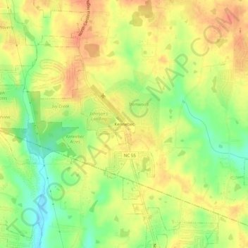
Name: Kennebec topographic map, elevation, terrain.

Location: Kennebec, Angier, Wake County, North Carolina, United States (35.52016 -78.76724 35.56016 -78.72724)

Average elevation: 99 m

Minimum elevation: 71 m

Maximum elevation: 118 m

Gear up for your next adventure:

🧦Thermal Socks - Warm socks for winter hiking or camping
Camping Groundsheet - Protect your tent from moisture and dirt
🦶Anti-Blister Balm - Prevents friction and hotspots during long ascents
🥾Mountain Hiking Boots - High-traction boots for rocky terrain
🥤Collapsible Travel Cup - Saves space and weight in your mess kit

As an Amazon Associate, this site earns from qualifying purchases at no extra cost to you.