Geolocate

Malabar topographic map

Click on the map to display elevation.

About this map

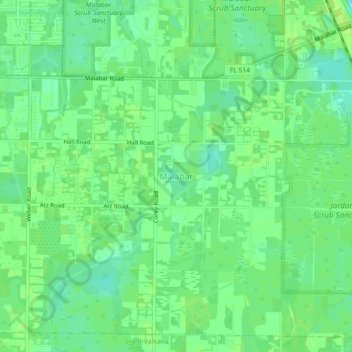
Name: Malabar topographic map, elevation, terrain.

Location: Malabar, Brevard County, Florida, 32950, United States (27.96697 -80.60702 28.00697 -80.56702)

Average elevation: 8 m

Minimum elevation: 0 m

Maximum elevation: 13 m

Gear up for your next adventure:

🧤Rechargeable Heated Gloves - Extreme warmth for Canadian winter expeditions
📷Outdoor Action Camera - Capture high-elevation views and rugged adventures
🧴First Aid Kit - Essential first aid supplies for outdoor emergencies
🥾Waterproof Trail Shoes - Shoes designed to handle wet terrain
🕶️Polarized Sunglasses - Reduces glare from snow and water at high elevations

As an Amazon Associate, this site earns from qualifying purchases at no extra cost to you.