Geolocate

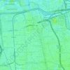
Cakung Timur topographic map

Click on the map to display elevation.

About this map

Name: Cakung Timur topographic map, elevation, terrain.

Location: Cakung Timur, Cakung, East Jakarta, Special Capital Region of Jakarta, 13910, Indonesia (-6.19373 106.94109 -6.15509 106.97188)

Average elevation: 6 m

Minimum elevation: 0 m

Maximum elevation: 11 m

Other topographic maps

Click on a map to view its topography, its elevation and its terrain.

Gear up for your next adventure:

🧢Outdoor Visor - Breathable visor for sunny hikes
🚲Bike Repair Kit - Essential tools for on-trail mechanical issues
🔭Compact Binoculars - Lightweight optics for scouting trails and wildlife
💧Hydration Pack - Hands-free hydration system for long hikes
🔨Vehicle Emergency Tool - Safety tool for remote road trips to trailheads

As an Amazon Associate, this site earns from qualifying purchases at no extra cost to you.