Geolocate

Palca topographic map

Click on the map to display elevation.

About this map

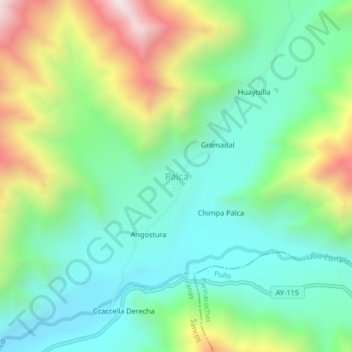
Name: Palca topographic map, elevation, terrain.

Location: Palca, Sancos, Lucanas, Ayacucho, Perú (-15.24492 -74.24618 -15.20492 -74.20618)

Average elevation: 1,183 m

Minimum elevation: 844 m

Maximum elevation: 1,909 m

Gear up for your next adventure:

🛁Quick-Dry Microfiber Towel - Space-saving towel that dries rapidly on the move
🧢Outdoor Cap - Protective cap for sun and rain during hikes
🥾Mountaineering Boots - Supportive boots for climbing and high-altitude hiking
🧤Insulated Winter Gloves - Heavy-duty protection for sub-zero Canadian adventures
🥾Lightweight Hiking Shoes - Comfortable shoes for day hikes

As an Amazon Associate, this site earns from qualifying purchases at no extra cost to you.