
Thank you for supporting this site ❤️
Make a donation
Make a donation
Gear up for your next adventure:
As an Amazon Associate, this site earns from qualifying purchases at no extra cost to you.
Legarda topographic map
Click on the map to display elevation.
Thank you for supporting this site ❤️
Make a donation
Make a donation
Gear up for your next adventure:
As an Amazon Associate, this site earns from qualifying purchases at no extra cost to you.
About this map
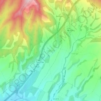
Name: Legarda topographic map, elevation, terrain.
Location: Legarda, Izarbeibar, Navarre, 31133, Spain (42.69134 -1.79271 42.73134 -1.75271)
Average elevation: 510 m
Minimum elevation: 389 m
Maximum elevation: 734 m
Thank you for supporting this site ❤️
Make a donation
Make a donation
Gear up for your next adventure:
As an Amazon Associate, this site earns from qualifying purchases at no extra cost to you.